
NASA satellites catch Australia's desert bloom from orbit
NASA Earth Observatory's Landsat comparison shows a stronger 2026 wildflower bloom in Western Australia after above-average winter rain.
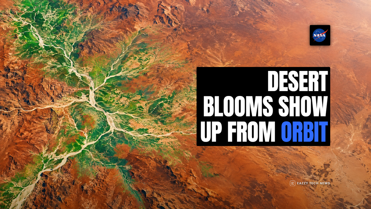
NASA's latest Western Australia image story shows how quickly a dry landscape can change when winter rain wakes dormant desert seeds.
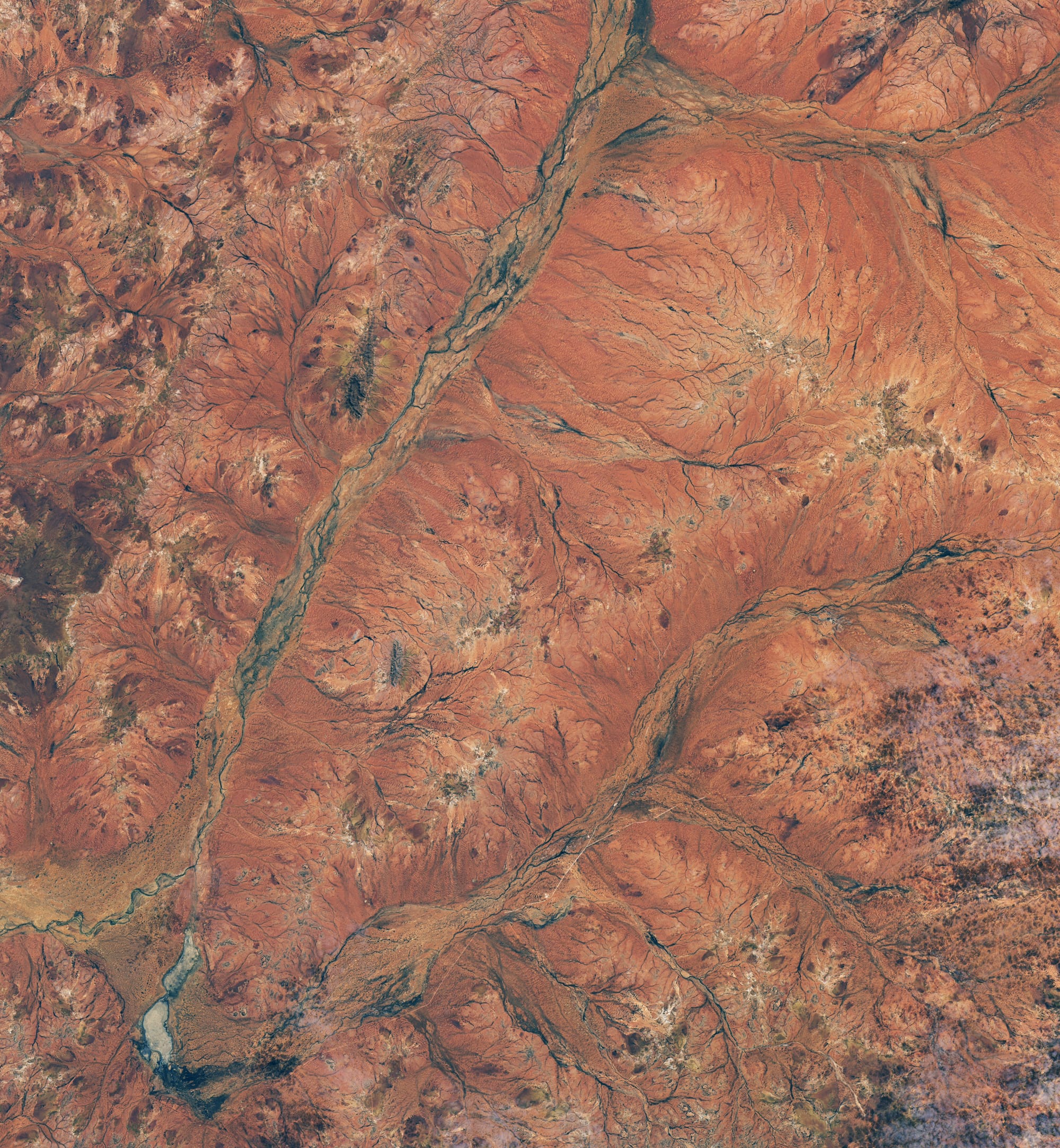
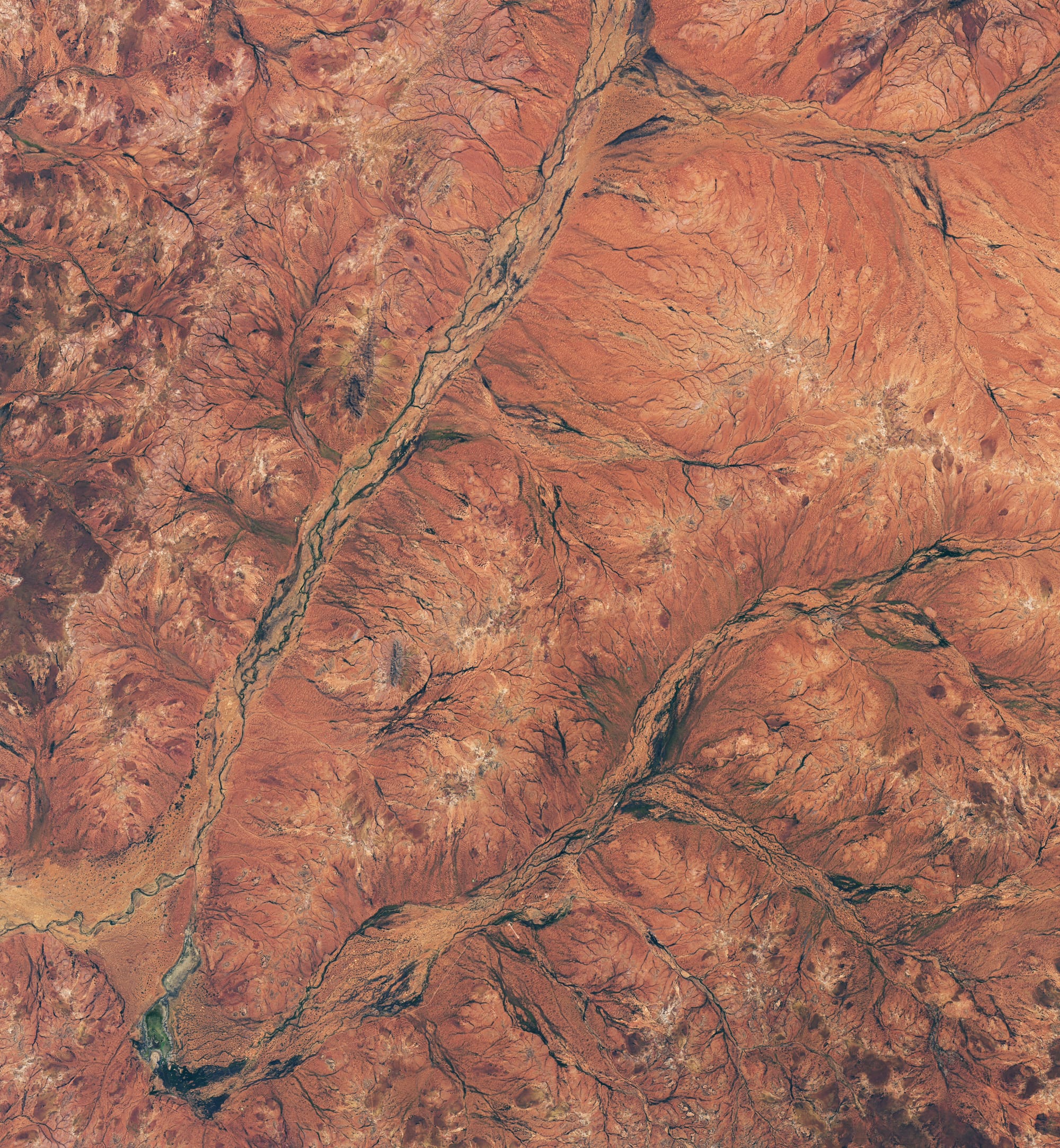
NASA Earth Observatory published the comparison on September 23, using Landsat 8 views from August 19, 2025 and August 30, 2026. The 2026 scene shows more green across the Murchison region, about 600 kilometers north of Perth, after wetter-than-normal months helped trigger a widespread wildflower bloom.
What changed in the satellite view
The useful detail is the side-by-side timing. The 2025 image gives a late-winter baseline, while the 2026 image shows greener riverbeds and surrounding vegetation after rain. NASA says arid shrublands in Western Australia were bursting with wildflowers in late austral winter 2026, with dormant seeds responding after wetter conditions earlier in the year.
Landsat 8 matters because it records the same region with consistent instruments over time. That lets analysts compare landscape color, vegetation and drainage patterns without depending only on ground reports from a few roads or stations. In this case, the orbital view turns a seasonal bloom into measurable evidence across a broad outback region.
Why rain timing matters
The Murchison region is usually dry enough that many plants wait for the right conditions before investing energy in growth and flowering. NASA cites Australia's Bureau of Meteorology data showing rainfall totals above average in June and very much above average in August after several cold fronts moved through the area. That sequence gave dormant seeds enough moisture to produce carpets of blooms.
The mechanism is simple: rain reaches the soil, seeds that can survive dry periods germinate, and short-lived plants race through growth and flowering while water is available. Satellite sensors do not identify every flower species from orbit, but they do show the broader greening signal that follows the rain.
The technology angle
This is an Earth-observation story because it shows why long-running satellite records are useful beyond disaster response. Landsat's value comes from repeatability. When a sensor family keeps watching the same land for years, scientists can separate a normal seasonal shift from a standout year.
The same approach supports agriculture, grazing, conservation and climate monitoring. A greener image does not automatically mean long-term recovery, and a single bloom does not erase drought risk. It does show where water moved through the landscape and where plants responded strongly enough for orbiting instruments to pick up the change.
NASA also notes ground context from CSIRO photographs taken on September 16, 2026. Those photos show white flowers carpeting parts of the outback, while the Landsat scenes show the wider regional pattern. The two views work together: satellites provide scale, and ground photos explain what the color change looks like at human level.
The practical takeaway is that remote sensing can make a brief ecological event visible before it disappears. Wildflower blooms can be spectacular and short-lived. A satellite comparison preserves the timing, the location and the scale of the change for researchers, land managers and anyone trying to understand how dry ecosystems respond when rain finally arrives.



Comments ()