
NASA satellites show Lake Powell hitting a new record low
NASA Earth Observatory's new Landsat comparison shows Lake Powell at a record-low level, linking satellite monitoring to water and power risk in the Colorado River system.
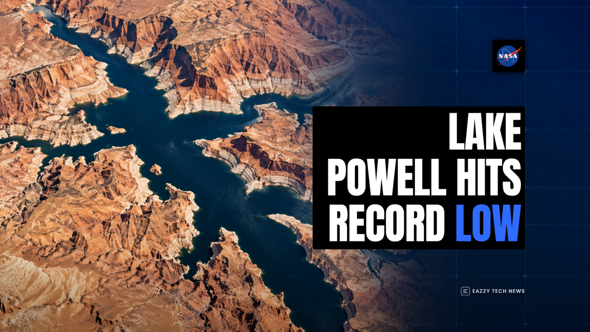
NASA's latest Lake Powell images turn a water-management problem into something anyone can see from orbit: the reservoir has narrowed into branching dark channels where broad bays held water less than a decade ago.
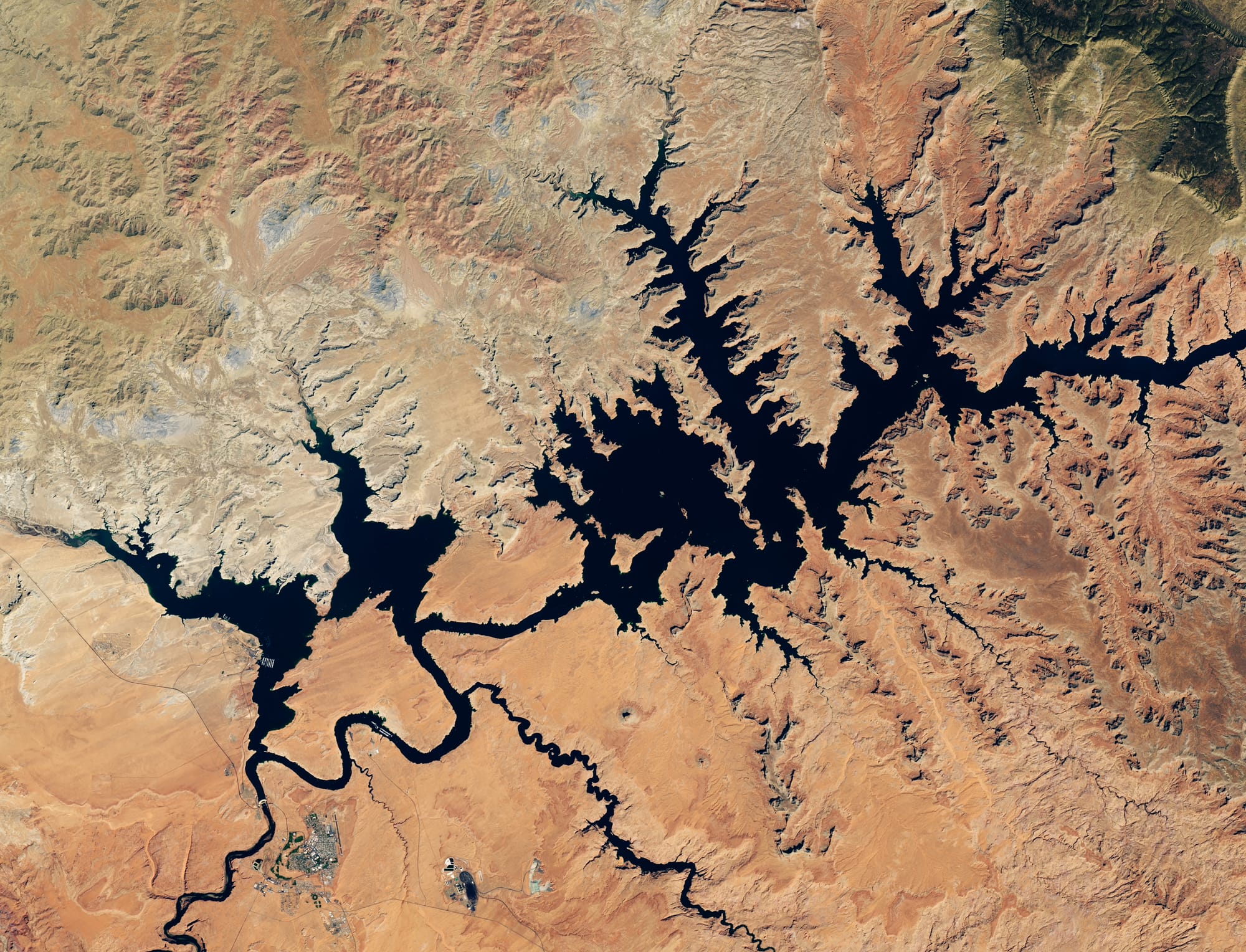
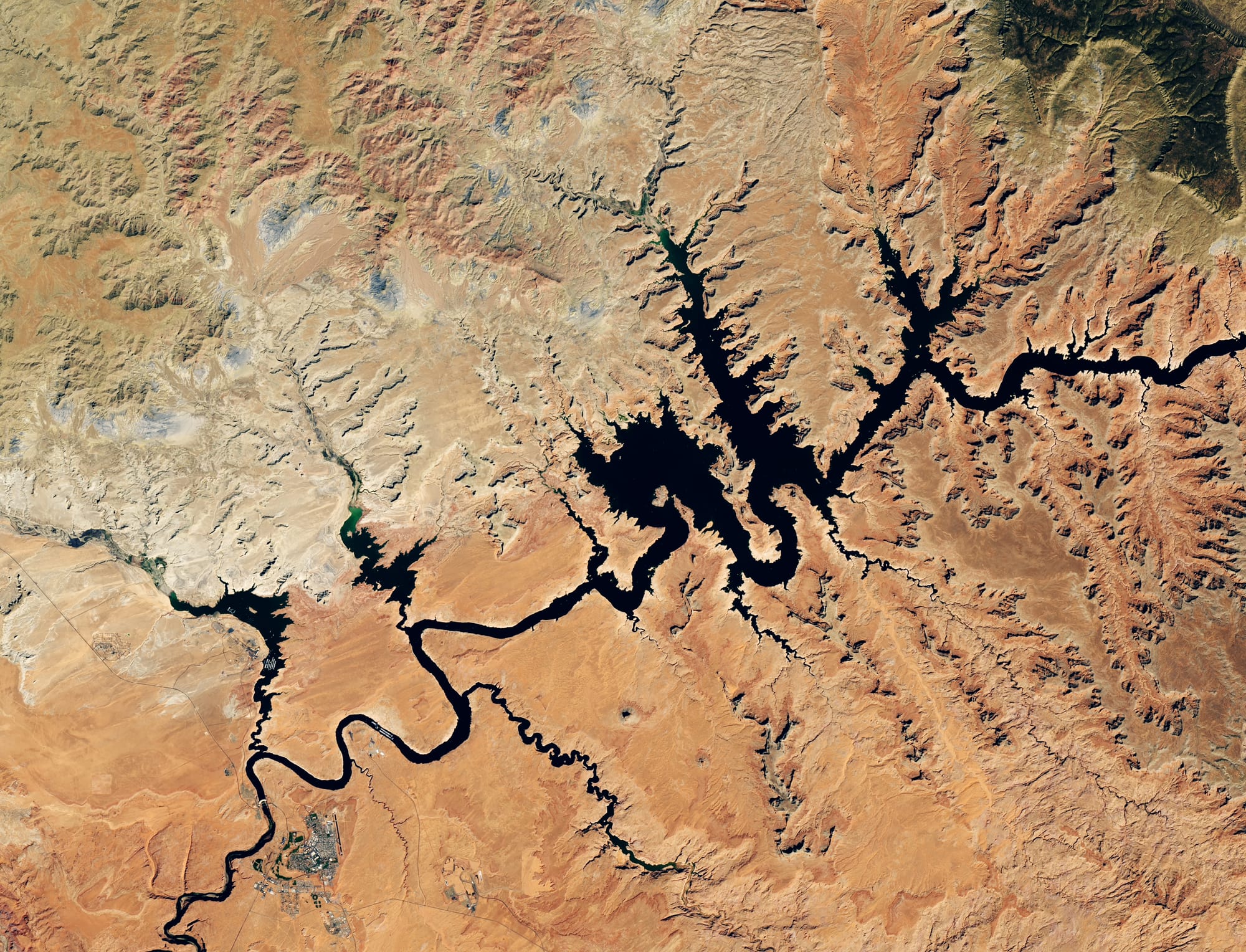
NASA Earth Observatory published the comparison on September 18, using Landsat 8 views from September 1, 2017 and September 10, 2026. The 2026 reading put Lake Powell at 3,517.24 feet, below the previous record-low level of 3,519.92 feet set on April 13, 2023. For a reservoir that helps store Colorado River water and support Glen Canyon Dam operations, the image is a satellite-measured warning about how little margin remains after a weak snow year.
What the satellite comparison shows
The images cover the area just above Glen Canyon Dam near Page, Arizona. In the 2017 frame, dark water fills many side canyons and wider bays. In the 2026 frame, the same geography looks more like a narrow river system through exposed orange rock. That before-and-after view matters because satellites make the change visible at the scale of the whole reservoir, not only at a gauge or boat ramp.
NASA says the images were captured by the Operational Land Imager, or OLI, on the NASA-USGS Landsat 8 satellite. OLI is a sensor that records reflected sunlight in multiple wavelengths, letting analysts map land and water features consistently over time. In plain language, the same satellite family can revisit the same reservoir and show whether water is spreading across side canyons or retreating into the main channel.
| Marker | Reported level | Why it matters |
|---|---|---|
| September 10, 2026 | 3,517.24 feet | NASA's image-day measurement for the new record-low comparison. |
| April 13, 2023 | 3,519.92 feet | The previous record-low benchmark that 2026 fell below. |
| Glen Canyon Dam hydropower threshold | 3,490 feet | Below this level, NASA says the dam's turbines can no longer generate energy effectively. |
Why 2026 pushed the reservoir lower
The near-term driver was a weak mountain snowpack across the Upper Colorado Basin during winter 2025-2026. NASA describes that as a snow drought, meaning the mountain snow that normally feeds spring runoff was unusually scarce. Record warmth also reduced the snowpack, so seasonal melt did less than usual to refill the reservoir.
That mechanism is important. Reservoir levels are not only about rainfall at the lake itself. Much of the Colorado River's flow starts as high-elevation snow. If snow accumulation is low, or if warm conditions reduce how much meltwater reaches the river, the shortage moves downstream into Lake Powell and then toward Lake Mead.
The practical consequence
The Colorado River system serves more than a scenic canyon. NASA notes that it provides water and electric power for more than 40 million people, including users in Las Vegas, Phoenix, Los Angeles and San Diego, and supports irrigation for millions of acres of farmland. A record-low Lake Powell therefore touches water storage, power generation, agricultural planning and drought response at the same time.
NASA also points to the role of monitoring tools. Landsat supplies the long-running visual record. The U.S. Bureau of Reclamation supplies lake-elevation data. NASA Earthdata describes dashboards that combine soil moisture, snow water equivalent and evapotranspiration, a measure of water moving from land and plants into the atmosphere. Together, those systems let agencies see whether the basin is entering spring with enough stored snow, whether soil is dry enough to absorb runoff, and whether reservoir levels are moving toward operational thresholds.
The images do not by themselves decide water policy. They do make the physical state of the system harder to abstract away. A single level reading can sound technical. A side-by-side satellite view shows what that number means on the ground: exposed canyon walls, narrower water, and a reservoir that has less buffer against the next dry stretch.



Comments ()